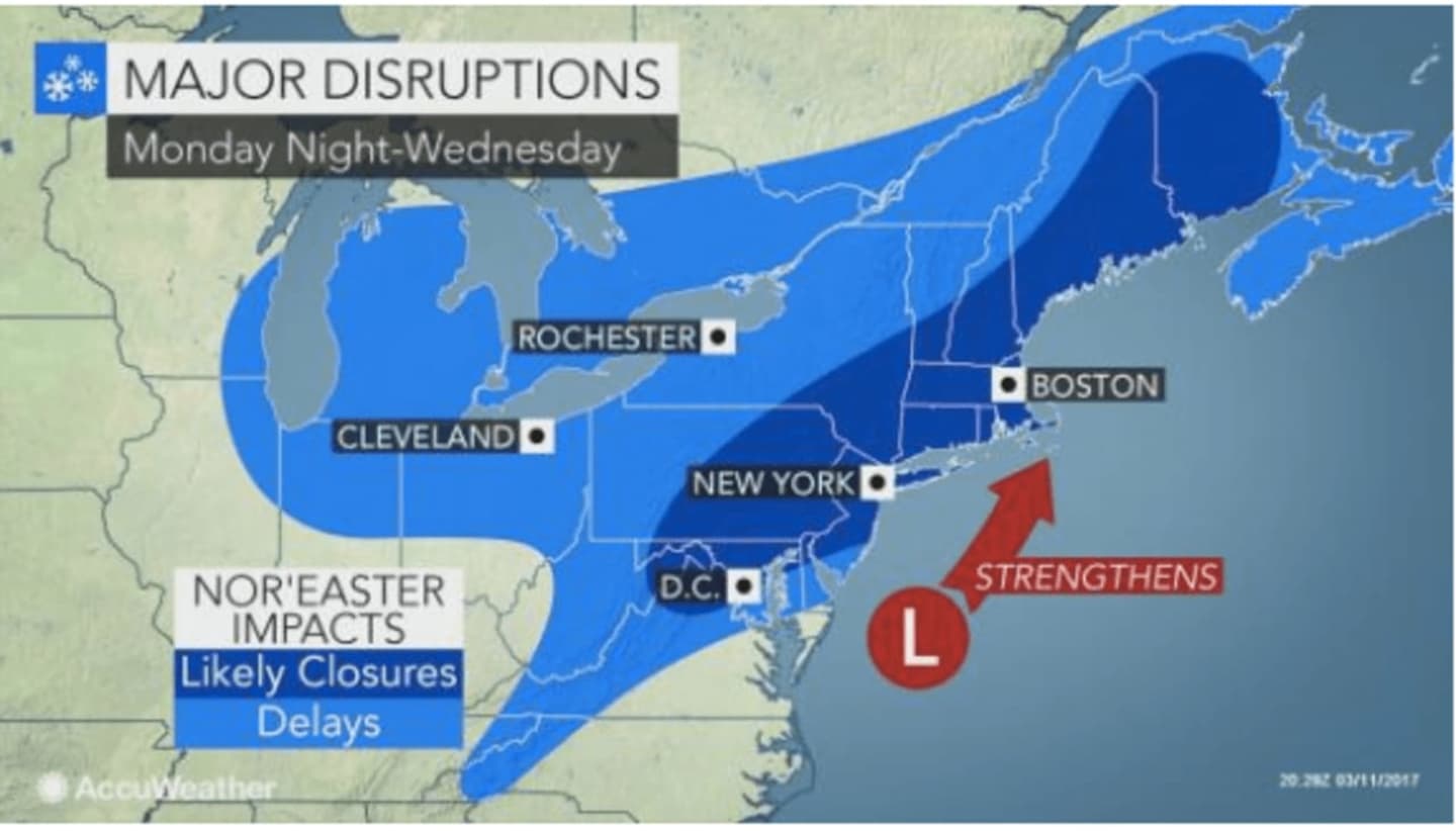

DUTCHESS COUNTY, N.Y. -- Snowfall accumulation projections for Dutchess have increased in advance of the major Nor'easter expected to arrive in the area late Monday night.
In advance of the storm, the National Weather Service has issued a rundown of what we know now in advance of the storm, saying there is potential for:
Significant snowfall
Strong winds
Coastal flooding
Shifts in the storm's track would have major importance:
A shift to the west closer to the coast would increase the potential for mixed precipitation/rain for the coast and lead to more snow inland.
A shift farther offshore to the east would increase the potential for heavy snow/blizzard conditions closer to the coast.
The major Nor'easter, expected to arrive overnight Monday into Tuesday, will bring with it heavy snow and gusty winds that could lead to power outages.
The National Weather Service is now projecting 12 inches or more of snowfall accumulation in Dutchess from the storm, with as much as two feet possible in spots. Shifts in the track (as noted) could increase, or even decrease, that projection for Dutchess.
The Winter Storm Watch that had been issued for Dutchess has now been updated to a Winter Storm Warning. It's in effect from midnight Tuesday until 8 p.m. Wednesday. A Blizzard Watch has been issued for coastal New York.
A Blizzard Watch has been issued for Southern Westchester, New York City and Long Island, meaning there is a potential for falling and/or blowing snow with strong winds and extremely poor visibilities.
This can lead to whiteout conditions and make travel very dangerous.
The storm will be a relatively fast-moving system that will be preceded by bitterly cold days Sunday and Monday.
Sunday will be partly sunny with a high in the upper 20s and wind-chill values between zero and 10.
Monday will also be brisk with a high struggling to reach the freezing mark under partly sunny skies.
Snow is expected to arrive very late Monday night or in the early morning hours Tuesday with snow heavy at times during the day and snow showers lingering into Wednesday.
But there is still uncertainty surrounding the potential strength of the storm.
Be sure to check back to Daily Voice for updates on the timing and track of the Nor'easter.
You can share this story by clicking on the Facebook icon below.
Click here to follow Daily Voice Southwest Dutchess and receive free news updates.