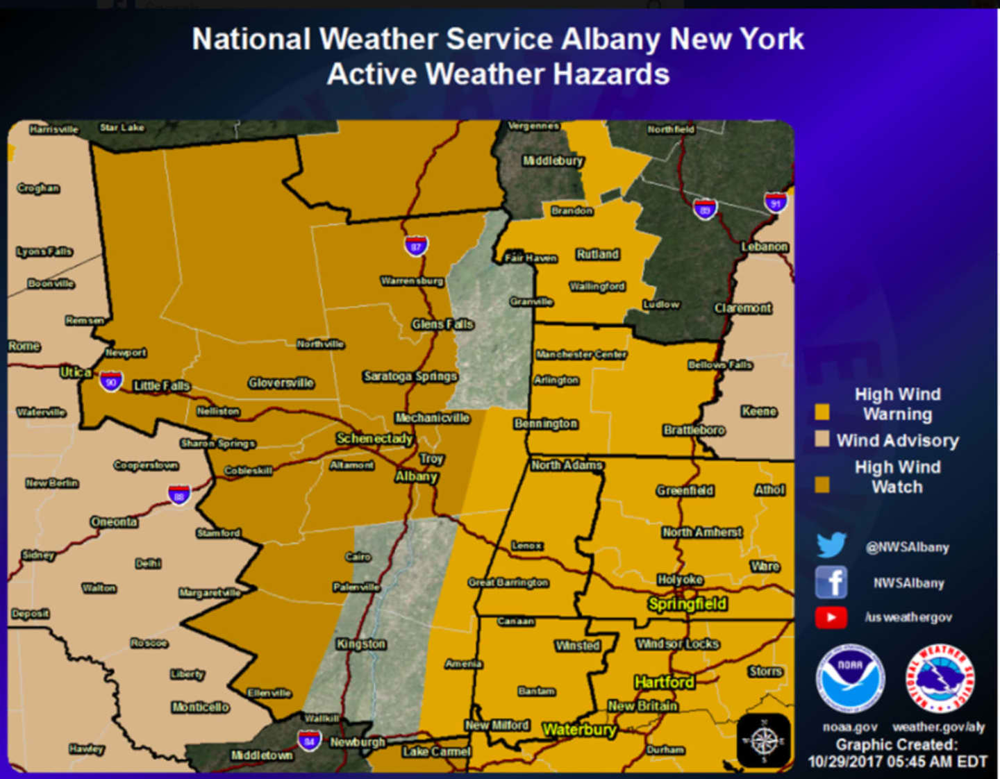
High Wind Warning is now in effect for Eastern Dutchess County from 6 p.m. Sunday until 6 a.m. Monday.
Sustained wind speeds of 40 to 58 mph are possible during this time in areas east of the Taconic State Parkway, according to the National Weather Service.
Downed trees and power lines that could cause power outages are possible.
Earlier report:
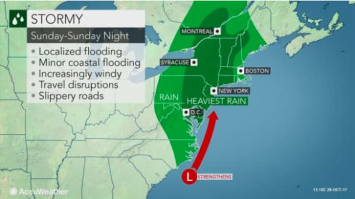
A major storm bringing Nor'easter-type conditions, including torrential downpours, is moving through Dutchess.
A Flash Flood Watch is in effect from 2 p.m. Sunday to noon Monday.
The watch also includes Putnam, Orange, Westchester and Rockland counties as well as southern Connecticut, northeast New Jersey, New York City and Long Island.
A Flash Flood Watch means that conditions may develop that lead to flash flooding, a very dangerous situation, the National Weather Service said in a statement, noting residents should monitor later forecasts and be prepared to take action should flash flood warnings be issued.
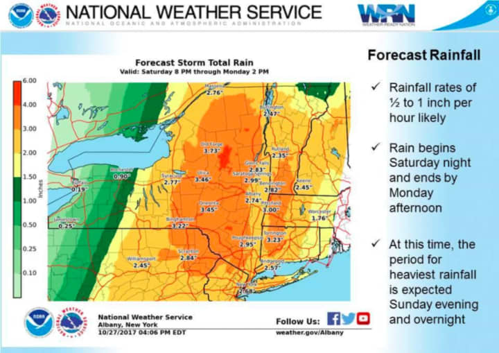
The storm could dump as much as 4 inches of rainfall.
A stormy Sunday, the fifth anniversary of Super Storm Sandy, will see showers and thunderstorms, with some of the storms producing heavy rain, with rainfall amounts of up to 2 inches possible during daylight hours.
Gusty winds of up to 28 miles per hour could bring down trees and cause power outages and be accompanied by flash flooding and locally severe storms.
Rain, which will be heavy at times, will continue Sunday night with another 1 to 2 inches possible.
Spotty showers will continue until around noontime Monday as the cold front passes through, bringing down temperatures. Monday's high will only be in the mid- to upper-50s with partly sunny skies in the afternoon. Strong winds are also possible Monday.
Check back to Daily Voice for updates on the storm.
Click here to follow Daily Voice Southwest Dutchess and receive free news updates.